Search This Blog

Sunday 4 December 2016

TOURMALINE IN QUARTZ LOCALITY WALLANGRA NSW


Photo by Wwoofa via the Australian Lapidary Forum
This is a well-known mineral collecting locality in northern NSW, on the western edge of what is commonly called the New England region. Unfortunately it is a place I’ve never visited so I am depending on the descriptions of others.

The Inverell Tourism website has this to say:  

“Wallangra Fossicking Area. Wallangra located north of Inverell has an area near the hall where you can hunt for Black Tourmaline in Quartz, once again this is a dry fossicking area. Contact Details: Wallangra Hall, Wallangra (65km north of Inverell) Ph: (02) 6728 8161.”

You may not find that particularly helpful. Knowing that the spot is near the Hall is good, but you also need to know that this is on the left hand side of the Yetman road. I’m sure you will find the place OK without ringing Wallangra. 
The spot is open freely to fossickers. Please do the right thing and leave your mechanical diggers at home. As well as your specimens, take home all your rubbish and other people’s as well if you come across any.

There is a stack of information available on the Australian Lapidary Forum. I suggest you become a forum member so you can access it. Here. You can then contribute to the Forum by telling members about your visit to Wallangra.

There are a number of websites describing visits to Wallangra. “Frosty’s Aussie Adventures” (here) should answer most of your questions. Thank you Wayne for showing us what should be available from the Inverell Tourism website.

I will point out at this stage that Wallangra and Wallangarra are quite different places. The latter is just across the NSW border into Queensland on the New England Highway.
This is an extract from the Inverell 1:250000 geological map. It shows that Wallangra is situated in an area marked Pg (Permian Granite, actually part of the Bundarra Suite).
The Australian Stratigraphic Units Database contains this definition of the “granites” of the Bundarra Suite:
Coarse- to very coarse-grained, porphyritic and equigranular (biotite)-(muscovite)-(garnet)-(cordierite) granite and leucogranite; K-feldspar megacrysts abundant in places.” This is the host rock in which the Wallangra tourmaline in quartz bodies are found.

I have been unable to find any account of the detailed geology of the occurrence.
Mindat (here), however, regards the site as significant. Here is what a search on the location produces:
“Latitude & Longitude (WGS84):
29° 13' 54'' South , 150° 53' 4'' East
Latitude & Longitude (decimal):
Located south of Texas, Qld.
Wallangra (in Northern New South Wales) was the site of a quarry, the area is now a designated Fossicking area. There is a quartz outcrop which contains tourmaline.

You will notice that the word ‘tourmaline’ is in quotes. This is because tourmaline is the name of a mineral family, rather than an individual mineral. In this case, the mineral is schorl – commonly called black tourmaline. If you want to read more about the tourmaline group, check this Mindat reference here.
Photo by Wwoofa via the Australian Lapidary Forum
Photo by earthound via the Australian Lapidary Forum

Wednesday 3 August 2016

THE TIN-MINING INDUSTRY IN NSW BY JE CARNE (1911)


The complete title of this book is “The Tin-Mining Industry and the Distribution of Tin Ores in New South Wales”. It is No. 14 in the Mineral Resources series, produced by the Geological Survey Branch of the NSW Department of Mines.
You can download a copy from DIGS (here). DIGS is an on-line collection of publications made available by the NSW Department of Industry (Resources and Energy). The reference number is R00050677. This book is an important resource for anyone interested in mining history and especially those wanting to locate and identify old mines and mineral deposits.
I have prepared a slide show using the numerous plates from this book (viewable on my YouTube site here).
I wish to acknowledge the source of these photographs now and thank the 
Geological Survey of NSW for making this resource available.
You will soon see if you look through the DIGS listings that there is a huge volume of literature on the subject of tin mining in NSW. Much was written before 1911 and a great deal more since. The New England region was at the heart of the industry. Locations such as Emmaville, Torrington, Tingha and Wilson’s Downfall stand out. Today, however, little mining is going on and it will take a substantial increase in the price of tin to get things moving again. The emphasis then will be on large scale mining and it looks as if the day of the solitary miner or small syndicate is over.

Here are the reference numbers for some other important documents relevant to the subject of tin mining.
The Mineral Resources of NSW (1901) by EF Pittman. DIGS reference number R00051137
The Mineral Industry of NSW by EC Andrews et al 1928. R00050818
Tin (Bulletin No 1) by EJ Kenny 1922. R00050981
Minerama book 1994 Cassiterite downloadable here.
All New England and other Geology blogs and videos.

Friday 22 July 2016

TOPAZ LOCALITIES WEST OF TORRINGTON NSW AUSTRALIA


In this blog I’ve attempted to bring together a list of all the places where topaz has been reported to the west of Torrington, in the New England region of NSW. So as not to repeat a lot of what I’ve already written, I’ve given references to some of my articles (in John’s New England Minerals blog). In some cases the reference to topaz may be very minor.
Please note that many of these locations are on private property and you will need permission from the owner to enter.
There are a number of useful references you can download. Firstly, there is the Minerama booklet “Topaz” (here). This gives information and references on many topaz localities in the New England region. (You will need to search Google to find a downloadable copy of this booklet. In searching use topaz book Minerama 1995 as key words.
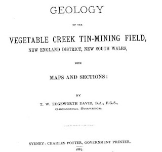
Secondly, there is Edgeworth David’s report on the Vegetable Creek Tin Field, published in 1887. It contains an amazing amount of information on what is still a pretty remote part of the country. At the time the report was compiled, only 50 years had passed since the first Europeans entered the district. You will need to go to DIGS (here). The reference number R00030528 will bring up a PDF of a 2 page map which is invaluable in locating old mines and workings. The same map, but on a single page this time, is at the very end of the report itself, for which the reference number is R00031676.
Thirdly, there are the Grafton-Maclean and Inverell metallogenic maps and data sheets, which are comprehensive reports covering all significant (and often insignificant) mines and mineral deposits, with lots of geological and mineralogical details. The respective DIGS reference numbers are R00056102 and R00050906 .
Fourthly, there is the mineral data base Mindat (here), where searching can often bring up information on a particular location. Much of this has been extracted from the previously mentioned reports.
Here are the links to areas already covered in my Blog:
Scrubby Gully topaz
Gaden’s Lode Gulf Road Emmaville (here)
Specimen Hill, The Gulf Near Emmaville (here)
The Gulf Fluorite Mine Near Emmaville (here)
Scrubby Gully, Torrington (here)
Surface Hill Gem Deposit Gulf Road Emmaville (here)
The Emerald Mine, near Emmaville (here).
These are well known localities, which have been visited by collectors and gem hunters for many years. This is not to say that there is nothing of interest left, on the contrary we continue to hear of attractive (and sometimes valuable) specimens being found in these places.
Fossicking at Surface Hill
West of the Beardy River, and entirely on the Inverell 1:250000 sheet, David reported the existence of numerous alluvial tin deposits, many of which are “deep leads”, lying beneath the extensive basalt flows which cover much of the area. I haven’t heard of anyone looking for gems in the area, but David’s descriptions mentions them several times.
The familiar ones are at Scrubby Gully and Surface Hill (both east of the Beardy). Links to my blogs on these are given above. That the topaz, beryl etc at SG and SH have originated from pegmatites around the edges and roof of 
Cross section of a lead (David)
the Mole Granite is beyond doubt. The same is most likely to be true of the deposits listed below. These gem bearing alluvials are probably derived from sources which have long since eroded away.
All these quotations are from David.
The Kangaroo Flat Lead. Details are on pages 93-94. The location is to the west of  Emmaville. “near the north-east corner of Portion 45, Arvid, at the Avoca Mine near the north-east corners of 104 and 105 in the same parish.”The gravel averages 2 feet in thickness, and is composed principally of flattish, oval pebbles of claystone 2-3 inches in diameter, and well-worn pebbles and grains of quartz; and gem-stones, as green beryl, emerald, sapphire, topaz etc and fine grains of stream tin chiefly black.”
Hall’s Sugarloaf. Details are on page 95. “Half a mile south-west of Foley’s is Hall’s Sugarloaf, a
small outlier of basalt capping stanniferous gravel.”The deposit may be described as a “cement” consisting of pebbles of claystone 3 inches in diameter with small well worn quartz pebbles, quartz sand, and small gems, as topaz and beryl, set in white and grey pipeclay, which has been baked in places into a tough natural brick.” Quite a few other mines in the area are also described, but no mention is made of gemstones. I think we can safely assume that gems are present in the wash at these places.
The Rocky Creek Lead. “The tertiary country embraced under this name extends from Cockatoo to the water-parting between the Severn and Dumaresq Rivers in the parish of Lorne, a distance of 9 miles.” “At the Basalt Hills the gravel has been tested by several shafts and two tunnels. The alluvial beds are composed chiefly of fine quartz sands such as results from the waste of quartz-porphyry (containing a number of beryls), with pebbles of claystone up to 1 inch in diameter.”
The Gem Lead has been proved to be a rich feeder, falling into the main body of basalt from the north-east.” “The commencement is in an outlier of quartz sand and gravel, capped by basalt in portion 38, Lorne.” “The richest yield here was 3 tons of stream tin from 70 cubic yards of wash. Emeralds and sapphires are associated with this stream tin.”
The Ruby Hill Lead. “The width of the volcanic formation varies from 5 chains to 2 miles.” “Constituents of the gravel are well rolled pebbles of clear and opaque quartz, red and black jasper, and pebbles of quartz-porphyry, the last attaining the diameter of 1 foot. Zircons and sapphires are plentifully intermixed with the stream tin.”
Beginning on page 164 David gives a summary of gems found in the Vegetable Creek area.
I would be delighted to hear from anyone who makes gemstone discoveries in this area. The comments area below can be used.

Sunday 6 March 2016

SMITH’S MICA LODE TORRINGTON

In 1993 Minerama adopted beryl as its theme mineral for that year’s show. This led to the compilation of the “Beryl” booklet (downloadable here (No longer available there. You can find it now in this blog) mineral displays and several field trips to beryl localities. One place the organisers visited was Smith’s Mica Lode at Torrington, shown to us by John Griffey. This was the only time I visited the place, but I kept some of the specimens until we moved from Glen Innes in 2013. They contained more beryl crystals (all opaque, sadly) than I have seen from any other locality near Torrington.
Derived from MINDAT. The pink crystal locates Smith's Mica Lode. The granite country and the Torrington sedimentary pendant can easily be distinguished.

It wasn’t easy to get to then and presumably it isn’t today. Access was through private land from the site of Tungsten village and then on foot through the Torrington State Forest. The outcrop is of pegmatite in which beryl, biotite and feldspar dominate. As you can see from the various maps included in this blog, the site is within the Torrington State Forest. It is a couple of hundred metres from the granite boundary and the country rock is sedimentary strata into which the pegmatite dyke has intruded from the granite beneath.
From a 1981 publication on mining at Torrington. Smith's Mica Lode is located top centre. The blue line locates the edge of the granite.

The "Beryl” booklet incorporates quotations from several sources (all of which are no doubt downloadable from DIGS. The link to DIGS is here.) I won’t repeat any of this information here. The one reference I have included dates from 1972 but I can’t track down the source. I found it during a search of DIGS. 
The Grafton Maclean Metallogenic Map locates Smith’s Mica Lode by the number 0551. (Green circle, top centre.) The accompanying notes tell us that Be, Bi, W, U, Sn, Zn and Cu minerals have been found there. Mindat (to be found here) gives the following information:

“Smiths mica (Mica lode; Smiths mica mine; Junction reefs), Torrington, Clive Co., New South Wales, Australia. Mineral List: Beryl, 'Biotite', Cassiterite, 'Monazite', Muscovite

Located approximately 7.5km North of Torrington. Coordinates: 370705mE, 6763668mN.
Operated as a shaft and shallow pits 1907 to 1921 and later 1954 to 1957. Grafton-MacLean 1:250 000 map sheet.

The other numbered localities nearby are:

0011 Wren’s NW Workings. Topaz, W, Bi.

0060 The Black Swamp Creek Alluvials. Mindat states: “Black Swamp Creek Alluvials, Torrington, Clive Co., New South Wales, Australia. Located approximately 6 km North of Torrington. Dredging operations from 1907 and sporadically through to late 1950s. Mineral List: Cassiterite, Corundum, 'Monazite', Quartz, Topaz.

This location appears to contain just what fossickers are looking for. Burnt Hut Creek is also part of this system. I would expect to find beryl in the gravel; take note that beryl does not concentrate in a sieve because of its relatively low specific gravity.

0546 Poor Prospect. Mindat states: “Poor Prospect, Torrington, Clive Co., New South Wales, Australia. Located approximately 7 km North of Torrington. Operated as shallow pits. Mineral List: Quartz, 'Wolframite'.

0547 The Wet Deposit. Mindat states: “Wet deposit, Torrington, Clive Co., New South Wales, Australia. Located approximately 7 km North of Torrington. Operated as shaft and shallow pits. Mineral List: Quartz, 'Wolframite'.”

0548 Junction Prospect. Mindat states: “Junction prospect, Torrington, Clive Co., New South Wales, Australia. Located approximately 7 km North of Torrington. Operated as shallow pits. Mineral List: 'Biotite', Muscovite var: Sericite, Quartz, 'Wolframite'.”

0549 Fletcher’s Deposit. Mindat states: “Fletchers deposit, Torrington, Clive Co., New South Wales, Australia. Located approximately 7.5 km North-West of Torrington.
Operated as underground workings, shafts and shallow pits 1913 to 1921. Mineral List: 'Limonite', 'Limonite', Muscovite var: Sericite, Quartz, 'Wolframite', Muscovite var: Sericite, Quartz, 'Wolframite'.

0550 Roberts Lode. Mindat states: “Roberts Lode. Located approximately 7.5 km North of Torrington. Operated as a shaft and numerous shallow pits 1910. Mineral List 'Wolframite'.”
0584 Lonely Deposit. Mindat states: “Lonely Deposit, Torrington, Clive Co., New South Wales, Australia. Located approximately 7 km North-West of Torrington. Operated as shallow pits. Mineral List: Quartz, 'Wolframite'.”
1326 Upper Black Swamp Lodes. Topaz, quartz.

From the Beryl book (1993). Specimen from Smith's Mica Lode.


All New England and other Geology blogs and videos