 |
| Extract from "Diamonds in NSW" |
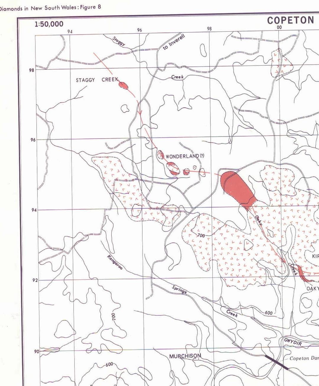
Staggy Creek reserve is one of the few places in NSW
where fossickers can go and have at least some chance of finding an alluvial
diamond. It’s part of an extensive deep lead lying beneath the basalt, south of
Inverell. Tin (cassiterite) was the main mineral being sought by miners in this
area in the nineteenth century and diamonds were discovered during the search. This
created a lot of interest at the time – and still does, judging by the amount
of prospecting that has been going on during the last twenty years. Search DIGS
(here) using “Staggy Creek” as
the locality and you will be surprised.
There’s a lot
of good background information in my Blog “Alluvial
Diamond Mining in the New England Region of NSW Australia” (here) and
especially in the NSW Geological Survey publication “Diamonds in New South Wales”. You can download a copy from DIGS;
the reference number is R00047949.
I’ve been there just once, at least
25 years ago. All I can remember finding is pieces of black tourmaline, which
are everywhere.
Here’s what the Inverell Tourism
website (here) has to say about Staggy Creek:
 |
| Copeton diamonds - Australian Museum |
Contact
Details: Copeton Dam Road (24km from the turn off Copeton Dam from Inverell)”
This is what “Diamonds
in NSW” has to say about the place.
 |
| Photo courtesy of Jewellery Pirate |
“The Staggy Creek deposit is an isolated area of diamond-bearing
Tertiary gravels exposed at the surface. There is no basalt overlying the
deposit and granite bedrock surrounds the Tertiary gravels. The granite is
remarkable in that it contains a number of potholes of circular shape and its
surface appears to be the surface on which the Tertiary sediments were
deposited.
The deposit consists of quartz pebbles, cobbles and
boulders ranging from 5mm to 0.2m in diameter, jasper, a relatively large
amount of tourmaline (much of which is unabraded), topaz and garnet (which is
invariably present in the diamond bearing gravels). Many of the quartz boulders
contains pencil tourmaline. An ironstone band similar to those at Kirk’s Hill
and the Banca is present.” Read page 52 of
the report for a fuller description.
Mindat (here) includes
a reference to Staggy Creek.
 |
| Photo courtesy of Jewellery Pirate |
“Staggy Creek lead, Copeton Dam, Hardinge
Co., New South Wales, Australia
Latitude & Longitude (WGS84):
|
29° 50'
5'' South , 150° 53' 5'' East
|
Latitude & Longitude (decimal):
|
Map sheets: SH 56-5, 9038-II-N. Coordinates: 295600mE, 6697500mN.
Placer deposit.
Placer deposit.
Rather strangely, the Mindat list doesn’t include
‘tourmaline’, the most obvious mineral at Staggy Creek.
Here is a list of other resources
you will find interesting.
 |
| Photo courtesy of Jewellery Pirate |
An account of a visit by the Campelltown Lapidary
Club (here).
Paul Clacher’s visit (here). (missing)
All Travels website (here). (useless)
World of Shiny Stuff website (here). (also missing)Sorry about all this missing material. I hope the other material in this blog will get you there and keep you happy. John February 2024
https://johnsbluemountainsblog.blogspot.com/2013/12/links-to-all-blog-entries-and-relevant.html
All Blue Mountains blogs and videos
All New England and other Geology blogs and videos